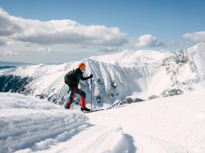
Ski touring route n°1: Plan Bois
Sainte-Foy-Tarentaise, Savoie, FR
Min Elevation
1523m
Max Elevation
1774m
Elevation Gain
251m
Elevation Loss
251m
Distance
1.9 km
Est. Time
-
About this Track
A short ski touring route starting from the heart of the resort (St Germain chapel). Follow route n°1 to reach the top of the Plan Bois chairlift. After the chapel, turn left at the picnic table and climb through meadows and forest to reach the Plan Bois plateau. Descent possible via the Charmette slope.
Location
- Country FR
- State/Region Savoie
- City 73640 Sainte-Foy-Tarentaise
- Latitude 45.578590
- Longitude 6.893980
Photos
Community Photos
Photos shared by community members
No community photos yet. Be the first to share!
Login to upload photosNo photos available for this track.
Additional Information
Parking: Sainte-Foy-Tarentaise Resort
Access: Departure from the St Germain chapel in the heart of the resort
Safety: Check openings before departure, especially in case of avalanche triggering operations (PIDA). Descent possible during ski area opening hours.
Source
View Original SourceContact Information
Sainte Foy Tarentaise Tourisme
Auvergne-Rhône-AlpesTourism office for the Sainte Foy Tarentaise ski resort
Contact Details
-
Address 130 Placette du Brenzet
73640 Sainte-Foy-Tarentaise
FR -
Phone +33 (0)4 79 06 95 19
-
Email info@saintefoy.net
-
Website Visit Website
Elevation Profile
Loading elevation data...
Track Conditions
No condition reports yet. Be the first to report!