Tracouet
Haute-Nendaz, Valais, CH
Min Elevation
1329m
Max Elevation
2195m
Elevation Gain
842m
Elevation Loss
37m
Distance
4.9 km
Est. Time
2h40
About this Track
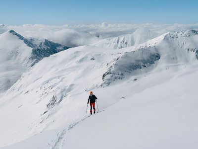
This route, starting from the Tracouet cable car, allows you to reach Tracouet via the trail located beneath the cable car. It requires some technical skills to reach the summit smoothly.
Location
- Country CH
- State/Region Valais
- City 1997 Haute-Nendaz
- Latitude 46.179964
- Longitude 7.291448
Photos
Community Photos
Photos shared by community members
No community photos yet. Be the first to share!
Login to upload photosNo photos available for this track.
Additional Information
Access: At the foot of the Tracouet ski run
Safety: This itinerary requires some training before venturing there.
Source
View Original SourceContact Information
Nendaz Tourisme
ValaisInformation center for the Haute-Nendaz and 4 Vallées region
Contact Details
-
Address Route de la Télécabine 1
1997 Haute-Nendaz
CH -
Phone +41 27 289 55 89
-
Email info@nendaz.ch
-
Website Visit Website
Elevation Profile
Loading elevation data...
Track Conditions
No condition reports yet. Be the first to report!