Argentière / La Trapette
Argentière, Haute-Savoie, FR
Min Elevation
1252m
Max Elevation
1972m
Elevation Gain
730m
Elevation Loss
-
Distance
5.0 km
Est. Time
2h30
About this Track
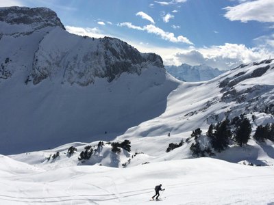
This route joins the cross-country ski track before climbing through the forest via a steep zigzagging path. The arrival is below the Plan Joran restaurant, then continues towards Lognan. The descent is via the Pierre à Ric.
Location
- Country FR
- State/Region Haute-Savoie
- City 74400 Argentière
- Latitude 45.978380
- Longitude 6.929371
Photos
Community Photos
Photos shared by community members
No community photos yet. Be the first to share!
Login to upload photosNo photos available for this track.
Additional Information
Parking: Main Grands Montets car park
Access: Follow the Pierre à Ric slope to the bridge, then follow the yellow markings towards the forest.
Safety: Regular markings (yellow signs). Route not maintained or secured. Beacon/probe/shovel recommended.
Source
View Original SourceContact Information
Office de Tourisme de la Vallée de Chamonix-Mont-Blanc
Auvergne-Rhône-AlpesMain tourism office for the Chamonix valley
Contact Details
-
Address 85 Place du Triangle de l'Amitié
74400 Chamonix-Mont-Blanc
FR -
Phone +33 (0)4 50 53 00 24
-
Email info@chamonix.com
-
Website Visit Website
Track Conditions
No condition reports yet. Be the first to report!