Juifen
Achenkirch, Tyrol, AT
Min Elevation
-
Max Elevation
1985m
Elevation Gain
1050m
Elevation Loss
59m
Distance
7.5 km
Est. Time
3h30
About this Track
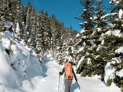
The tour to the Juifen is simple but not exactly short. It leads to a shapely, panoramic peak. In the lower area, it stretches over long distances on forest and alpine paths. The Juifen belongs to the Vorkarwendel and offers a great view. Starting from the Falkenmoos car park, a wide path leads through forests and mountain pastures to the Falkenmoosalm and Großzemmalm. The ascent continues to the Lämpereralm and finally to the grassy summit ridge.
Location
- Country AT
- State/Region Tyrol
- City 6215 Achenkirch
- Latitude 47.545400
- Longitude 11.698090
Photos
Community Photos
Photos shared by community members
No community photos yet. Be the first to share!
Login to upload photosNo photos available for this track.
Additional Information
Parking: Falkenmoos car park in Achenkirch (paid parking)
Access: Take regional bus line 4080 to Achenkirch and get off at the 'Achenkirch Abzw. Steinberg a. R.' stop.
Safety: Standard winter hiking equipment. Check avalanche conditions locally.
Source
View Original SourceContact Information
Achensee Tourismus
TirolTourism board for Tirol's largest lake in Austria
Contact Details
-
Address Achenseestraße 63
6212 Maurach am Achensee
AT -
Phone +43 5 95300-0
-
Email info@achensee.com
-
Website Visit Website
Elevation Profile
Loading elevation data...
Track Conditions
No condition reports yet. Be the first to report!