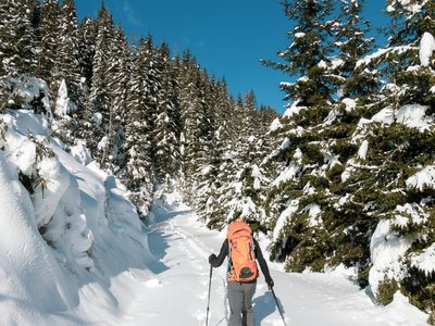
Peynier Track
Vars, Hautes-Alpes, FR
Min Elevation
1899m
Max Elevation
2250m
Elevation Gain
351m
Elevation Loss
-
Distance
4.0 km
Est. Time
3h
About this Track
Your outing starts behind the Lauzet residence towards the Fontbonne chairlift. After contemplating the view from the summit, you can enjoy the descent by using the blue larch and Serre Meyrand slopes during the opening hours of the ski area (9:00 AM to 4:30 PM).
Location
- Country FR
- State/Region Hautes-Alpes
- City 05560 Vars
- Latitude 44.568813
- Longitude 6.685698
Photos
Community Photos
Photos shared by community members
No community photos yet. Be the first to share!
Login to upload photosNo photos available for this track.
Additional Information
Parking: Vars les Claux (Lauzet Residence)
Access: Behind the Lauzet residence
Safety: Marked route. Max slope 25%. Consult the avalanche bulletin.
Source
View Original SourceContact Information
Vars Tourisme
Provence-Alpes-Côte d'AzurTourism Office for Vars La Forêt Blanche
Contact Details
-
Address Cours Fontanarosa
05560 Vars
FR -
Phone +33 (0)4 92 46 51 31
-
Email info@vars.com
-
Website Visit Website
Track Conditions
No condition reports yet. Be the first to report!