Le Parraouis
Adervielle-Pouchergues, Hautes-Pyrénées, FR
Min Elevation
1460m
Max Elevation
2062m
Elevation Gain
592m
Elevation Loss
-
Distance
2.8 km
Est. Time
-
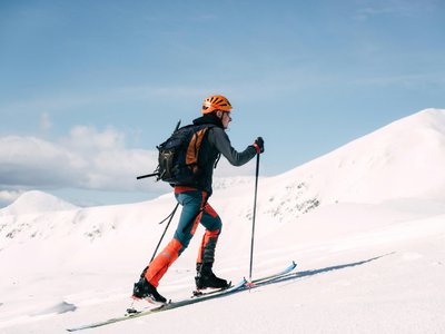
About this Track
The 2nd ski touring route in Val Louron to reach the top of the resort. Route accessible only during the opening hours of the ski area. The descent is via the Lapadé and Tuco slopes. In case of difficult weather or snow conditions, the route may be closed by the slope service. Route marked with yellow signs.
Location
- Country FR
- State/Region Hautes-Pyrénées
- City 65240 Adervielle-Pouchergues
- Latitude 42.789560
- Longitude 0.389780
Photos
Community Photos
Photos shared by community members
No community photos yet. Be the first to share!
Login to upload photosNo photos available for this track.
Additional Information
Parking: Val Louron 1450 - Trounquet
Access: Adervielle-Pouchergues
Safety: Check with the slope service for opening status. Bring safety equipment (avalanche transceiver, shovel, probe). Consult the Avalanche Risk Bulletin (BRA).
Source
View Original SourceContact Information
Contact Details
-
Phone +33 (0)5 62 99 95 00
-
Email info@val-louron-ski.com
Elevation Profile
Loading elevation data...
Track Conditions
No condition reports yet. Be the first to report!