Pierrot du Col
Combloux, Haute-Savoie, FR
Min Elevation
1576m
Max Elevation
1754m
Elevation Gain
597m
Elevation Loss
-
Distance
4.1 km
Est. Time
2h
About this Track
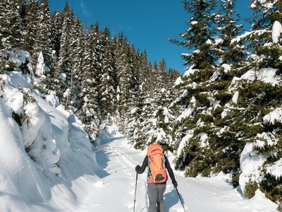
This more athletic route takes you to the summits of the Combloux ski area. From La Cry, you head up towards the Jaillet sector. The route alternates between forest sections and panoramic views of Mont Blanc. Reaching the Col offers an exceptional panorama before starting the descent.
Location
- Country FR
- State/Region Haute-Savoie
- City 74920 Combloux
- Latitude 45.869910
- Longitude 6.599090
Photos
Community Photos
Photos shared by community members
No community photos yet. Be the first to share!
Login to upload photosNo photos available for this track.
Additional Information
Parking: La Cry car park
Access: Access via La Cry car park, Combloux
Safety: Mountain route. Check slope openings and snow report before departure.
Source
View Original SourceContact Information
Office de Tourisme de Combloux
Haute-SavoieTourism office for the village of Combloux
Contact Details
-
Address Place de l'Église
74700 Combloux
FR -
Phone +33 4 50 58 60 49
-
Email info@combloux.com
-
Website Visit Website
Elevation Profile
Loading elevation data...
Track Conditions
No condition reports yet. Be the first to report!