Plagne Bellecôte - Col de Forcle
La Plagne, Savoie, FR
Min Elevation
1930m
Max Elevation
2280m
Elevation Gain
350m
Elevation Loss
-
Distance
5.0 km
Est. Time
-
About this Track
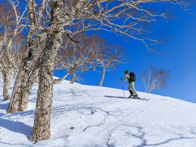
Ideal route for beginners, alternating groomed and 'off-piste' sections with a magnificent view of Mont Blanc. The last part is not groomed to get familiar with off-piste progression.
Location
- Country FR
- State/Region Savoie
- City 73210 La Plagne
- Latitude 45.500774
- Longitude 6.703092
Photos
Community Photos
Photos shared by community members
No community photos yet. Be the first to share!
Login to upload photosNo photos available for this track.
Additional Information
Parking: Plagne Bellecôte parking lots
Access: Departure above the Roche de Mio gondola station
Safety: Warning: route shared with pedestrians at the beginning. Descent recommended via the blue 'Ours' slope.
Source
View Original SourceContact Information
Office de Tourisme de La Grande Plagne
Auvergne-Rhône-AlpesTourism office for La Plagne ski resort
Contact Details
-
Address B.P. 4
73210 Aime-la-Plagne
FR -
Phone +33 (0)4 79 09 02 01
-
Email info@la-plagne.com
-
Website Visit Website
Track Conditions
No condition reports yet. Be the first to report!