Saint-Véran
Saint-Véran, Hautes-Alpes, FR
Min Elevation
2066m
Max Elevation
2410m
Elevation Gain
340m
Elevation Loss
4m
Distance
1.6 km
Est. Time
1h30
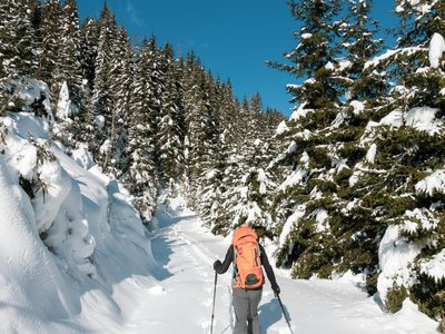
About this Track
A well-marked route, well-prepared equipment (shovel, probe, transceiver) and a departure from Saint-Véran, it's just perfect! And you descend on groomed slopes.
Location
- Country FR
- State/Region Hautes-Alpes
- City 05350 Saint-Véran
- Latitude 44.701790
- Longitude 6.867630
Photos
Community Photos
Photos shared by community members
No community photos yet. Be the first to share!
Login to upload photosNo photos available for this track.
Additional Information
Parking: Saint-Véran
Access: Departure Saint-Véran
Safety: Transceiver, shovel, probe mandatory. Unsecured route. Closed during avalanche risk levels 4 and 5.
Source
View Original SourceContact Information
Office de Tourisme du Guillestrois et du Queyras
Provence-Alpes-Côte d'AzurTourism Office for the Guillestrois and Queyras region
Contact Details
-
Address Maison du Tourisme
05350 Château-Ville-Vieille
FR -
Phone +33 4 92 46 76 18
-
Website Visit Website
Elevation Profile
Loading elevation data...
Track Conditions
No condition reports yet. Be the first to report!