Gourette Ski Touring
Eaux-Bonnes, Nouvelle-Aquitaine, FR
Min Elevation
1340m
Max Elevation
2123m
Elevation Gain
800m
Elevation Loss
753m
Distance
0.8 km
Est. Time
1h30
About this Track
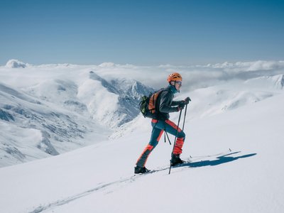
Route going up the Cotch sector to the place called 'Les Fontaines de Cotch', representing nearly 800m of elevation gain, with free access. The ascent is under the sole responsibility of the practitioner. The route consists of 4 sections that can be linked or completed individually: Bois de Saxe, La Sarrière, Les dômes de Davasse, and Les Fontaines.
Location
- Country FR
- State/Region Nouvelle-Aquitaine
- City 64440 Eaux-Bonnes
- Latitude 42.957872
- Longitude -0.332599
Photos
Community Photos
Photos shared by community members
No community photos yet. Be the first to share!
Login to upload photosNo photos available for this track.
Additional Information
Parking: None
Access: Cotch sector, departure via the sports trail at Bois de Saxe
Safety: The ascent is under the sole responsibility of the user.
Source
View Original SourceContact Information
EPSA Gourette / Bureau d'Information Touristique
Nouvelle-AquitaineTourism office for Gourette ski resort in the Pyrenees
Contact Details
-
Address Maison de Gourette
64440 Eaux-Bonnes
FR -
Phone +33 (0)5 59 05 12 60
-
Email info@gourette.com
-
Website Visit Website
Elevation Profile
Loading elevation data...
Track Conditions
No condition reports yet. Be the first to report!