'Yannick Ecoeur' Black Trail
Morgins, Valais, CH
Min Elevation
1314m
Max Elevation
2041m
Elevation Gain
750m
Elevation Loss
33m
Distance
5.3 km
Est. Time
2h30
About this Track
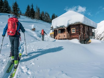
Designed by and named for local skimo champion Yannick Ecoeur, this is technically and physically the most demanding itinerary of the Rando Parc. Winds through steep, technical sections. Reward: panoramic views from the top of the Aiguille des Champeys.
Location
- Country CH
- State/Region Valais
- City 1875 Morgins
- Latitude 46.236596
- Longitude 6.856781
Photos
Community Photos
Photos shared by community members
No community photos yet. Be the first to share!
Login to upload photosNo photos available for this track.
Additional Information
Parking: Parking du 6 Août
Access: Place du 6 Août, Morgins
Safety: Requires experience in ski touring and excellent physical condition. Carry avalanche equipment.
Source
View Original SourceContact Information
Part of the Région Dents du Midi, focusing on Morgins and Portes du Soleil
Contact Details
-
Address Route de France 15
1875 Morgins
CH -
Phone +41 24 477 23 61
-
Email morgins@rddm.ch
-
Website Visit Website
Elevation Profile
Loading elevation data...
Track Conditions
No condition reports yet. Be the first to report!